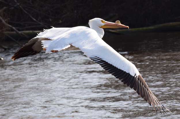
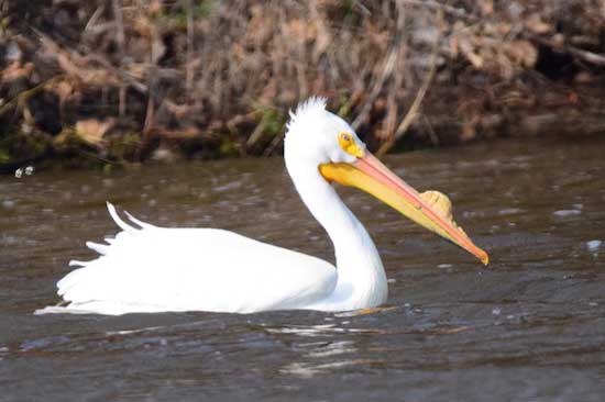
CARLTON – Doug Boyer, a nature photographer who lives by Lake Alice, captured these photos of a white pelican at the lake on Saturday.
“You will not believe we saw a white pelican today on Lake Alice, but I have 7 witnesses,” Boyer said in an email with the photos.
The Cornell Lab of Ornithology describes the white pelican as “a huge waterbird with very broad wings, a long neck, and a massive bill that gives the head a unique, long shape. They have thick bodies, short legs, and short, square tails. During the breeding season, adults grow an unusual projection or horn on the upper mandible near the tip of the bill.”
The white pelicans are typically found along coasts in winter, they can be found in California’s Central Valley, the Salton Sea, and the Colorado River drainage of California and Arizona. They also spend the winter in Florida.
“They are superb soarers (they are among the heaviest flying birds in the world) and often travel long distances in large flocks by soaring,” according to the Cornell Lab of Ornithology. “When flapping, their wingbeats are slow and methodical.”
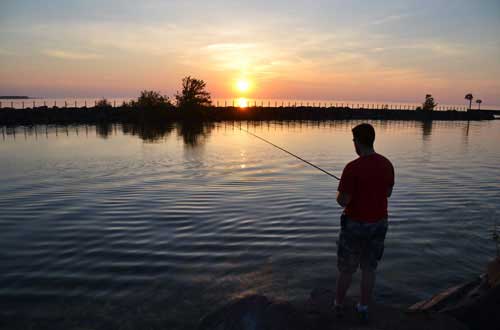
DEC will stock 31,350 brown trout in Lake Ontario at Carlton
File photo by Tom Rivers: This photo from May 28, 2015 shows Joel Fuller standing on a rock along the pier with the sun setting at Point Breeze.
The 2017 trout and salmon fishing season begins on Saturday. The best early season angling opportunities for trout are typically in lakes and ponds, with some of the best fishing found immediately after ice thaws, according to an announcement today from Gov. Andrew Cuomo.
The state Department of Environmental Conservation operates 12 fish hatcheries in New York and plans to stock more than 2.2 million catchable-size brook, brown and rainbow trout in 314 lakes and ponds and roughly 2,850 miles of streams across the state, which over the course of the spring will include 1.6 million brown trout, 426,300 rainbow trout, and 160,200 brook trout.
That’s in addition to the stocking of nearly 2 million yearling lake trout, steelhead, landlocked salmon, splake, Chinook salmon, and coho salmon that will grow over the years to become catchable size fish.
In Orleans County the DEC will stock 31,350 “catchable” brown trout in Lake Ontario at Carlton. Those fish will be 8 to 9 inches long.
“New York is home to world-class fishing in virtually every corner of the state,” Governor Cuomo said. “From the Catskills to the Adirondacks, from the Finger Lakes to Lake Ontario, or a small stream or neighborhood pond, I encourage New Yorkers and visitors alike to get out and enjoy all the great fishing that New York’s waters have to offer.”
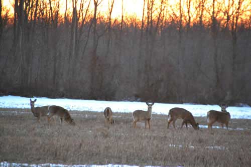
File photo by Tom Rivers: These deer are pictured in March 2015 on Route 98 in Gaines, south of 104.
The New York State Department of Environmental Conservation announced today that of the more than 2,400 white-tailed deer tested last season, none tested positive for Chronic Wasting Disease.
Since 2002, DEC has tested more than 40,000 wild white-tailed deer for CWD.
“Preventing the introduction of Chronic Wasting Disease in New York State is among DEC’s top wildlife priorities,” said DEC Commissioner Basil Seggos. “We’re working hard to ensure the health of our deer herd and to protect the recreational and viewing opportunities deer provide. We recognize that hunters play an important role in keeping CWD out of New York, because the most effective way to protect New York’s deer herd is to keep out CWD.”
CWD is a highly contagious disease that affects deer, elk, moose, and reindeer. CWD is always fatal and there are no vaccines or treatments available. CWD is caused by a misfolded protein called a “prion” that can infect animals through animal-to-animal contact or via contaminated environments.
In 2005, CWD was found in captive and wild white-tailed deer in Oneida County. After intensive disease response efforts, no subsequent cases have been detected. In the 2016-2017 surveillance period, 2,447 samples were tested from hunter-harvested deer and 102 clinical deer that appeared sick or abnormal. DEC partners with meat processors and taxidermists to obtain samples each year.
For wildlife diseases like CWD, prevention is the most effective management policy. There are several recommendations for both hunters and anyone that encounters deer that will prevent introduction of infectious prions, including:
Do not use deer urine-based lures or cover scents. Prions are shed in a deer’s bodily fluids before the deer appears sick. Prions bind to soil and plants and remain infectious to deer that ingest contaminated soil. There is no method of disinfection.
Dispose of carcass waste, even from New York deer, into a proper waste stream either by putting butcher scrap in with your household trash or otherwise assuring it ends up in a licensed landfill. Landowners may dispose of their own deer on their property, but it is illegal for businesses such as butchers and taxidermists to dispose of waste generated from their business in any way other than a landfill or rendering facility.
Debone or quarter your deer before you bring it back to New York. This practice removes “high risk” parts such as the brain and spinal cord that could potentially spread CWD. If a whole intact carcass is brought in from a prohibited state, province, or any high-fence shooting facility, the person will be ticketed and the entire animal, including trophy heads, will be confiscated and destroyed. Meat, hide and cape, antlers, cleaned skull cap with antlers attached, finished taxidermy mounts, tanned hides, and clean upper canine teeth are permitted.
Do not feed wild deer or moose. Animals concentrated together can spread disease quickly.
In the event of a CWD outbreak in New York, state agencies are prepared. DEC has an Interagency CWD Response Plan with the Department of Agriculture and Markets if the disease is detected in either captive cervids or wild white-tailed deer or moose. There are no documented cases of CWD infecting humans, but DEC urges caution when handling or processing CWD-susceptible animals.
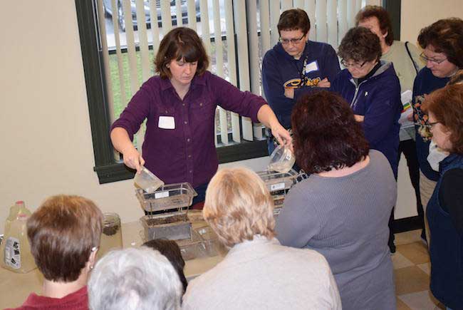
Photos courtesy of Katie Oakes: Jena Buckwell from Orleans County Soil and Water Conservation District demonstrates the effects of tillage on soil.
By Kristina Gabalski, Correspondent Posted 28 March 2017 at 10:07 am
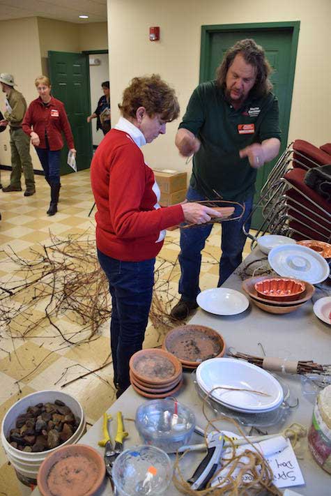
Master Gardener Alex Greene demonstrates how to make a bird/butterfly water bath using recycled materials.
KNOWLESVILLE – Gardeners from around Orleans County gathered this past Saturday at the Education Center on the Orleans County 4-H Fairgrounds to celebrate the start of spring and get prepared for the upcoming growing season.
Master Gardener volunteers hosted their annual Spring into Gardening Education Day and led several sessions on growing healthy plants.
“This fun-filled educational event featured presentations on eight different gardening topics taught by volunteers from Cornell Cooperative Extension programs as well as local non-profit organizations,” said Katie Oakes, Orleans County Cornell Cooperative Extension Horticulture Educator/Master Gardener coordinator.
Oakes said participation numbers this year were significantly higher than last year.
“Spring Ed Day is a fantastic start to our event season,” Oakes said. “We are really excited about what 2017 will bring for our volunteer group.”
Participants were able to select four sessions from the eight offered. Topics this year included gardening basics such as soil health led by Soil and Water Conservation District representative Jena Buckwell, Garden Composition with Master Gardener Karen Cavanaugh, Outdoor Mushroom Production with Wyoming County CCE Educator Don Gasiewiscz and pest management strategies with Master Gardener Michael Klepp.
“Everyone enjoyed the day,” Master Gardener president Barb Linhart said. “Many people had a hard time deciding which class to attend because all the topics were so interesting.”
Participant Susan Persia said she walked away with new and valuable information to start the gardening season.
“I think it was an excellent day,” she observed, “very well planned (and) something we can’t get every day.”
For more information on upcoming Master Gardener events for 2017, visit orleans.cce.cornell.edu.
Pat Bono from NY Bee Wellness poses with demonstration information following her presentation on honeybees.
By Tom Rivers, Editor Posted 22 March 2017 at 10:14 am
No fees or tolls for recreational boaters in 2017
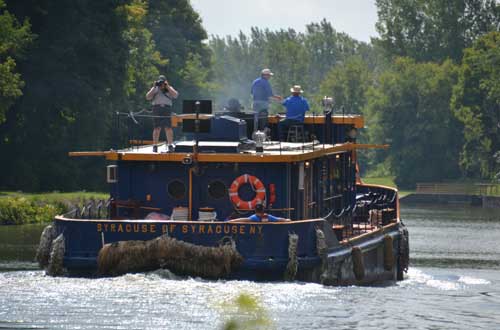
File photo by Tom Rivers: The Tug Syracuse is pictured on the canal in Hulberton on Aug. 21, 2014.
The Erie Canal will open about three weeks later than it did in 2016, according to a schedule announced by the State Canal Corp. on Tuesday.
The canal system will open on May 19 and continue until Oct. 11. Last year, the canal opened on April 27, its earliest opening day since 1982. A mild winter last year allowed staff to complete maintenance projects and get ready for the canal’s opening ahead of schedule.
The canal last year was open for boaters until Nov. 20. This year, it will close about six weeks earlier.
This year will be the first since the canal’s ownership was moved from the State Thruway Authority to the New York Power Authority. The Thruway Authority ran the canal system since 1992.
This year also marks the beginning of an eight-year bicentennial of the canal’s construction, which started in 1817 and was completed in 1825. In honor of the beginning of the 200th anniversary celebration, there will be no fees or tolls for recreational boaters in 2017.
The hours of operation for the 2017 season are as follows: May 19 to October 11: 7:00 a.m. to 5:00 p.m.
In addition to the boating schedule, the seven lift bridges in Orleans County will operate on demand from 7 a.m. to 10 p.m. from May 19 to September 13. Vessels are required to arrive at a lock at least 15 minutes prior to closing to ensure being locked through, and at a bridge at least 5 minutes prior to ensure an opening, the Canal Corporation said.
23 billion plastic bags annually have environmental, financial costs
Press Release, Gov. Andrew Cuomo’s Office
Governor Andrew M. Cuomo today announced the launch of the New York State Plastic Bag Task Force. The Task Force will be led by state Department of Environmental Conservation Commissioner Basil Seggos along with co-chairs Senator Thomas O’Mara and Assemblyman Steve Englebright. The working group will be charged with developing a report and proposed legislation to address the detrimental impact of plastic bags on the state’s environment.
“New York has led the nation by taking bold action to protect our environment – and this task force marks another step forward in that effort,” Governor Cuomo said. “The costly and negative impact of plastic bags on New York’s natural resources is a statewide issue that demands a statewide solution. This diverse coalition of experts will bring the experience and knowledge necessary to tackle this problem and safeguard New York’s environment for future generations.”
Members of the Task Force will work to develop a uniform and equitable statewide plan to address New York’s plastic bag problem. The Task Force will review information from municipalities about their experiences and proposed solutions. Members of the Task Force include:
• Basil Seggos, Commissioner, New York State Department of Environmental Conservation
• Senator Thomas O’Mara, New York State Senate
• Assemblyman Steve Englebright, New York State Assembly
• Stephen Acquario, Executive Director, New York State Association of Counties
• Marcia Bystryn, New York League of Conservation Voters
• Michael Rosen, Food Industry Alliance
Across New York, residents use 23 billion plastic bags annually. A significant number of these bags make their way into the environment causing litter and damaging wildlife, which can be seen within our waterways, along our streets and in our oceans and lakes. Moreover, these bags do not biodegrade – they persist for years.
The New York City Department of Sanitation currently estimates that it collects an average of 1,700 tons of plastic bags per week, costing $12.5 million per year in disposal expenses. As states across the nation struggle with the environmental and financial costs associated plastic bags – New York will lead the way in developing a comprehensive statewide solution.
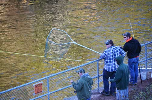
18-inch minimum size and daily creel limit of 3 established for walleye at Waterport Reservior
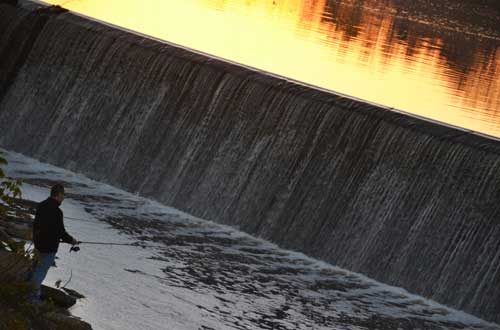
File photo by Tom Rivers: These fishermen are pictured on Oct. 11, 2014 at the Waterport Dam.
The state Department of Environmental Conservation announced today that new fishing regulations will take effect beginning April 1, with one change in Orleans County.
The DEC has established an 18-inch minimum size limit and daily creel limit of 3 for walleye in the Waterport Reservoir.
“New York State is known for fantastic freshwater sport fishing opportunities,” said Commissioner Seggos. “These regulatory changes will help maintain these opportunities and enthusiasm for the sport.”
The modifications to the sport fishing regulations are a result of a two-year process that included biological assessment, discussions with anglers, and a formal 45-day public comment period. DEC used public input to finalize the changes. These regulations will be published in the 2017-18 Freshwater Fishing Regulations Guide that will be available at all license sales vendors and on-line in March.
File photo by Tom Rivers: Pete Ricci of Waterport fishes near the dam in Lyndonville in this photo from Nov. 3, 2015. Johnson Creek in Lyndonville is one of several tributaries in Orleans County that are popular with anglers.
Press Release, DEC
The public will have the opportunity to learn about the state of Lake Ontario fisheries at public meetings held in Niagara, Monroe, and Oswego counties in March, New York State Department of Environmental Conservation Commissioner Basil Seggos announced.
“Lake Ontario and its tributaries continue to provide world-class fishing opportunities for the hundreds of thousands of anglers who enjoy it every year,” Commissioner Seggos said. “These fisheries provide unsurpassed recreational opportunity and generate substantial economic benefits to the surrounding communities. The state of Lake Ontario meetings provide an excellent opportunity for individuals interested in the lake and its tributaries to interact with the scientists and managers who study and manage these fisheries.”
Lake Ontario and its embayments and tributaries support thriving populations of fish, including a variety of trout and salmon, bass, walleye, yellow perch, and panfish. New York’s Lake Ontario waters comprise more than 2.7 million acres. A recent statewide angler survey estimated that more than 2.6 million angler days were spent on Lake Ontario and its major tributaries. The estimated value of these fisheries exceeded $112 million annually for local economies.
The meeting dates and locations are as follows:
• Tuesday, March 7: 6:30 to 9 p.m. at the Cornell Cooperative Extension Building, 4487 Lake Ave., Lockport, Niagara County. The meeting is co-hosted by Niagara County Cooperative Extension and the Niagara County Sportfishery Development Board.
• Thursday, March 9: 6:30 to 9 p.m. at the Rochester Institute of Technology (RIT) campus (Chester F. Carlson Center for Imaging Science building (76-1125) – Carlson Auditorium), Rochester, Monroe County. The meeting is co-hosted by RIT and the Monroe County Fishery Advisory Board.
• Monday, March 13: 6:30 to 9 p.m. at the Pulaski High School auditorium, 4624 Salina St., Pulaski, Oswego County. The meeting is co-hosted by the Eastern Lake Ontario Salmon and Trout Association. In the event of heavy lake-effect snow, the meeting will be held at the same time and location on March 14.
Staff from DEC, the United States Geological Survey, and the U.S. Fish and Wildlife Service will share presentations, including updates on the status of trout and salmon fisheries in the lake and its tributaries, forage fish, and stocking programs. The meetings will provide ample time at the end of the scheduled program for the audience to interact with the presenters.
Information about DEC’s Lake Ontario fisheries assessment programs can be found on DEC’s website. For additional information contact Steven LaPan, New York Great Lakes Fisheries Section Head at the Cape Vincent Fisheries Research Station, (315) 654-2147.
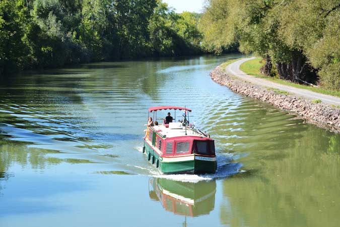
A canal boat named Canandaigua takes a leisurely trip on the Erie Canal in this photo from Sept. 23, 2015. The photo was taken from the Presbyterian Road canal bridge in Albion.
By Tom Rivers, Editor Posted 8 February 2017 at 1:06 pm
This is a big year for the Erie Canal, the historic waterway that transformed New York and the United States. 2017 starts the beginning of an eight-year bicentennial of the canal’s construction, which began in 1817 and finished in 1825.
The Erie is often referred to as a lowly “ditch.” But the canal was an incredible feat in its day, opening up commerce, turning New York into the Empire State and allowing for a western migration in the 1800s that led to fervent social and religious movements – abolition, temperance, women’s suffrage and more. Many leaders of those movements, such as Frederick Douglass and Susan B. Anthony, lived in canal communities.
Construction on the 363-mile manmade waterway started in 1817 in Rome. It took eight years to take down trees, remove stumps and clear a path across upstate, linking Buffalo to Albany.
The canal is still operational, a “working museum” with lift bridges, guard gates, waste weirs, and many tugboats, barges and pleasure boats.
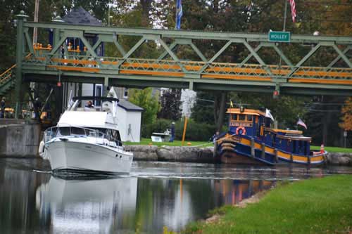
The lift bridge in Holley goes up to make room for a modern boat. The historic Urger, a tugboat from 1901, is pictured in back.
The canal also is increasingly popular for cyclists, joggers, and kayakers.
With this year the start of the bicentennial, it’s a good time to pay notice to the canal towns in Orleans.
Medina, Albion and Holley were busy spots along the canal and the wealth from the Erie’s heyday is still prominently on display in these villages.
Take a look at the towering churches, ornate government buildings, the stately mansions – even the beautiful historic cemeteries. They have artistry – in the architectural design, stained-glass windows (including 43 Tiffany windows in Albion), and the fine craftsmanship with the woodwork and stone carvings. (Before he become a multi-millionaire by building luxurious sleeping cars for railroads, George Pullman lived in Albion, making furniture and moving houses when the canal was widened.)
The canal brought wealth into the community, and the residents didn’t build cheap. They spared no expense leaving landmarks that remain community treasures today.
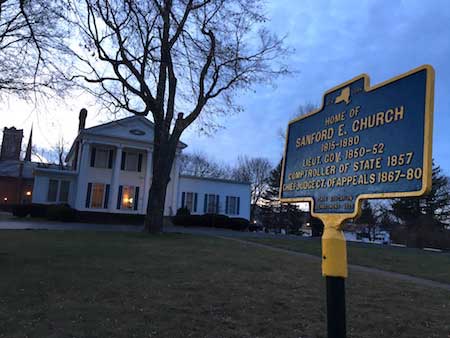
This house in Albion, now a funeral home, was once home of Sanford Church, a leading political figure in the state from 1850 to 1880.
Some of the canal towns around the state have lost some of the flavor from the canal prosperity in the 1800s. Mansions were leveled for chain stores, and other historic structures were lost “progress.”
In Orleans, the canal villages have persevered, keeping their historic downtown business districts, maintaining their houses of worship and staying diligent caretakers of the community’s most revered residences.
The canal was expanded from 1905 to 1918 to make more room for bigger boats. That “Barge Canal” from a century ago was recently declared a National Historic Landmark.
Only 16 lift bridges remain from the canal’s widening. Orleans County is home to seven of those bridges. When a boat passes underneath, the bells go off to warn traffic the bridge is going up.
It’s a throwback to a different era, and it’s very much a part of the county’s identity, a beloved institution.
If you’re visiting Orleans, be sure to stop and see one of the marvels of the canal – a bridge that moves up to accommodate a boat. How’s that for small-town hospitality.
(Editor’s Note: This was written with about 500 words as the introduction to the Lake Country Pennysaver’s annual Visitor’s Guide. Orleans Hub readers are welcome to take a 500-word challenge to promote Orleans County. Send the short essays to news@orleanshub.com.)
By Tom Rivers, Editor Posted 12 January 2017 at 10:07 pm
Photo by Tom Rivers: The Canal Basin in Medina is pictured in this photo from Oct. 28.
MEDINA – An Orleans County legislator wants the canal villages and towns to work together on a plan to better optimize the historic waterway.
Ken DeRoller met with Medina Village Board this week to discuss working on a Local Waterfront Revitalization Program for the canal communities.
Medina officials were open to teaming with the other towns and villages for a canal corridor plan in the county.
The county is currently working on a plan for about 25 miles of the Lake Ontario shoreline towns of Kendall, Carlton and Yates. The state approved a $40,000 grant to help with that effort.
DeRoller would like to see the canal villages and towns also pursue a plan that would bolster activities and attractions on the canal, whether for boating, biking, kayaking, people having picnics or doing other recreational activities.
The plan could also look at residential and commercial opportunities.
The county has added a planning professional who could assist with the project. DeRoller said he would like to hear from the other canal community leaders.
“This is just planting a seed,” he said after meeting with the Medina officials. “I would like to see a coordinated effort.”
For more on Local Waterfront Revitalization Programs, click here.
File photo by Tom Rivers: The tower of the Main Street lift bridge in Albion is pictured in this photo from March 2014. The lift bridge was built as part of the canal’s transitioning to the barge canal about a century ago.
Press Release, U.S. Sen. Kirsten Gillibrand
WASHINGTON, D.C. – U.S. Senator Kirsten Gillibrand today announced that after her year-long push, the New York State Barge Canal has been designated as a National Historic Landmark by the U.S. Department of Interior.
“The New York State Barge Canal has played a pivotal role in the growth and development of not only New York State but the entire country. It facilitated and shaped the course of settlement in the Northeast, Midwest and Great Plains, and established New York City as the nation’s premiere seaport and commercial center,” said Senator Gillibrand. “I was proud to fight for this designation because the canal is a symbolic reminder of New York’s excellence from the 1800s to this present day, honoring generations of our history and industry. Today, the New York State Barge Canal gets the recognition it truly deserves as it officially becomes a National Historic Landmark.”
In April, Senator Gillibrand first called on the National Park Service to designate of the NYS Canal as a National Historic Landmark. After the National Historic Landmarks Committee of the National Park System Advisory Board moved to approve the designation in November, Gillibrand renewed her pushed and urged the U.S. Department of the Interior to deliver the final approval needed to officially designate the NYS Canal as a National Historic Landmark.
The Beals Road bridge in Ridgeway is pictured during the winter. The bridge was built during the barge canal expansion.
Gillibrand was also instrumental in the New York Barge Canal being added to the National Park Service’s National Register of Historic Places in 2014, expanding opportunities for federal historic tax credits and other resources to support economic development initiatives near the Barge Canal, as well as positioning the Canal for designation as a National Historic Landmark.
The New York State’s Barge Canal system will celebrate its 192nd year of continuous operation next year. Also, the New York State Barge Canal will celebrate its Centennial in 2018.
The NYS Barge Canal extends through Albany, Syracuse, Rochester and Buffalo and includes the Erie Canal, the Oswego Canal, the Cayuga-Seneca Canal, and the Champlain Canal, stretching 525 miles across New York State.
By Tom Rivers, Editor Posted 22 December 2016 at 7:45 am
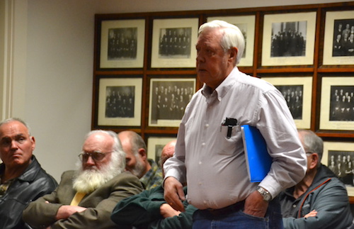
Photo by Tom Rivers: Neil Newton, a member of the Orleans County Sportsmen Federation and NYS Conservation Council, favors allowing rifles for hunting deer and bears.
ALBION – Orleans County legislators are being asked by sportsmen to allow rifles for big game hunting – deer and bears.
County legislators were told by Sportsmen Club leaders on Wednesday that 41 out of 62 counties, including counties with more residents than Orleans, allow rifles for hunting.
Mike Elam, treasurer of the Orleans County Sportsmen Federation, presented the Legislature with a petition signed by about 500 people, supporting center-fire rifles for deer hunting.
“As the times change so does technology,” said Jeff Atwell, president of the Barre Sportsmen Club.
He believes rifles are safer than shotguns, because hunters with rifles tend to use only one bullet. With shotguns, Atwell said hunters will often take multiple shots and slugs can “bounce.”
Terry Williams of Carlton, a hunting instructor for 40 years, also favors rifles for hunting. “You’re not overshooting,” he told county legislators.
Sportsmen leaders said studies have shown that rifles are safe for hunting deer and bears.
“The facts clearly support the passage of this proposal and the history of safety across New York with counties with far greater populations than Orleans County fully support it,” according to written comments from Michael Van Durme, a retired chief conservation officer for Region 8 of the DEC.
Van Durme’s career as a conservation officer included seven years in Orleans. He now manages a consulting company that specializes in hunter and firearms safety. He testified in favor of rifles for deer hunting when Genesee, Livingston and Ontario counties discussed the issue – those counties ultimately voted in favor of it.
He said hunting is much safer now than in the 1960s, when there were 19 incidents per 100,000 hunters. Now it’s 4.3 incidents per 100,000, he said.
Rifles are currently used in Orleans County to hunt smaller animals, with no injuries to hunters or the public, Van Durme said.
“Center-fire rifles are used almost all year long in Orleans County to hunt woodchucks, foxes, crows and coyotes, and there has never been a case of a bullet traveling miles from their target and hurting anyone,” Van Durme said in his written comments.
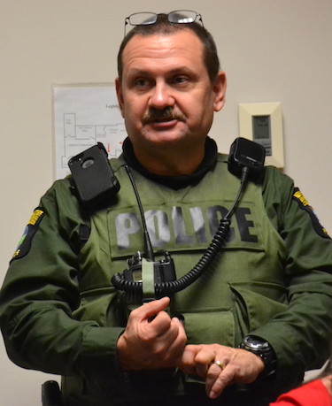
Paul Kroth, conservation officer, says he will enforce whatever laws are on the books. Ultimately, he said hunters are responsible for their shots.
Paul Kroth, a conservation officer in Orleans County, said whether or not rifles are allowed for deer hunting in Orleans, hunters still need to practice basic safety standards, such as identifying their target and knowing what is beyond it.
Some spots in Orleans aren’t appropriate for rifles, Kroth said, because roads and houses are too close by.
“Hunters, they’re still responsible for where their round goes,” Kroth said at a packed Legislature meeting. “There are a lot of smaller blocks where a rifle would not be appropriate.”
Hunters who use poor judgement and injure or even kill someone can face charges from reckless endangerment to manslaughter, Kroth said.
“We are going to enforce the law no matter which way you decide,” Kroth told the seven-member County Legislature.
David Callard, the Legislature chairman, said the group will continue to discuss the issue. He said the county doesn’t have the final say.
If the Legislature supports rifles for deer and bear hunting, Callard said local state legislators would then take the issue to Albany for a vote from the State Legislature.
By Tom Rivers, Editor Posted 17 December 2016 at 2:58 pm
Photos by Tom Rivers
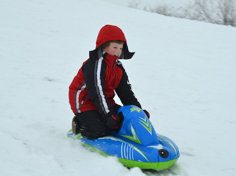
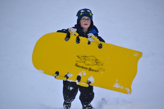
ALBION – Bobby Dysard, 12, of Albion leaps on a snowboard at Bullard Park this afternoon after the temperatures rose to the mid-30s and the wind died down.
Several kids were sledding at the park this afternoon.
Cole Moyle, 9, of Albion heads down the hill at Bullard.
Bryar Dysard, 9, joins his brother in enjoying some snow fun.
Justin Kania, 8, of Albion heads back up the sledding hill.
Anita Weese of Medina was at Mount Albion Cemetery with her English Labrador retrievers Zoe, left, and Hannah. Weese said it was a good afternoon for a walk at the historic cemetery.
By Tom Rivers, Editor Posted 15 December 2016 at 10:08 am
Photos by Tom Rivers
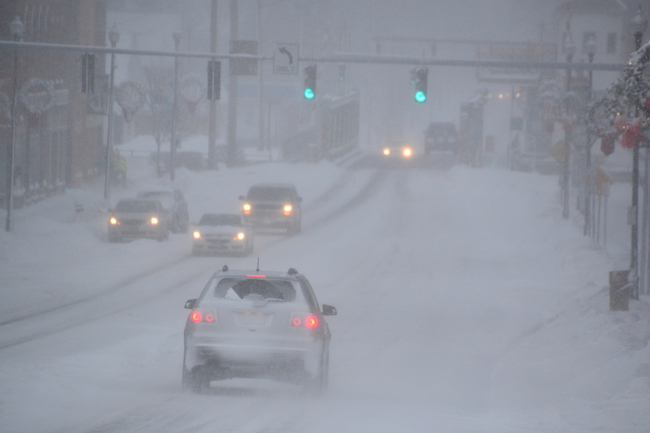
It’s white-out conditions at times driving in Orleans County today, with snow and wind making it difficult to see. This picture shows Main Street in Albion looking north towards the lift bridge on the Erie Canal at about 8:45 a.m.
Three school districts – Albion, Holley and Medina – cancelled school today and two others – Lyndonville and Kendall – are on two-hour delays.
A wreath on the door of the First Presbyterian Church has been blasted with snow.
The National Weather Service has issued a Winter Weather Advisory for Orleans, Niagara and Monroe counties until 5 a.m. on Friday. About 3-5 inches of snow is expected today with another 2 to 4 inches overnight. The snow, combined with 25 to 35 mile per hour winds and gusts up to 50 mph, will produce significant blowing and drifting snow.
“Strong winds and blowing snow will produce very difficult travel conditions at times with greatly reduced visibility and snow-covered roads,” the Weather Service said. “Wind chills dropping below zero will increase the risk of frostbite and hypothermia.”
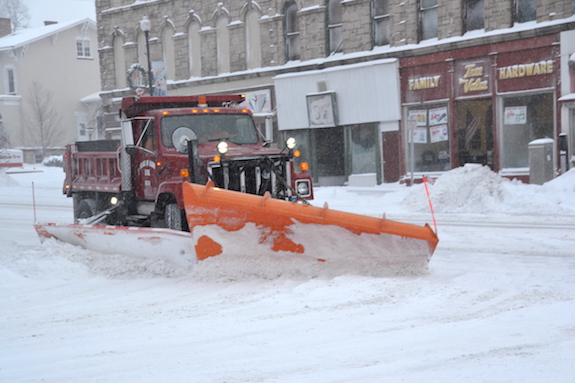
An Albion Department of Public Works plow truck pushes snow off Main Street this morning.
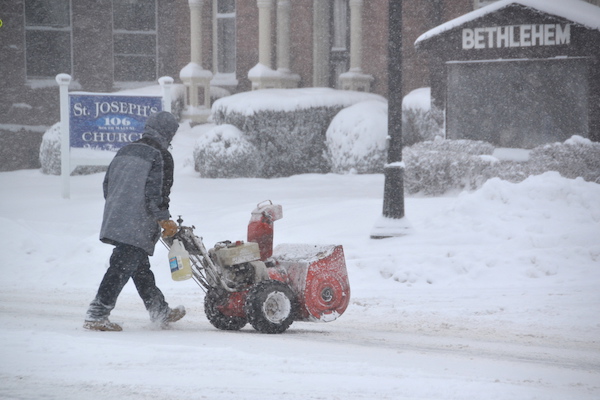
A man with a snowblower crosses Main Street near the Holy Family Parish.
By Tom Rivers, Editor Posted 10 December 2016 at 7:39 pm
Photos by Tom Rivers
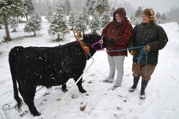
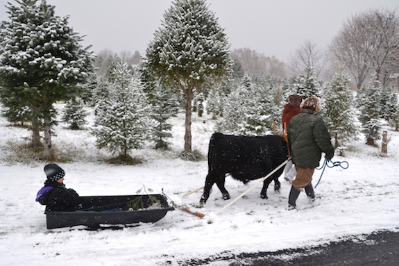
MURRAY – Arden, a male ox, was at Jim Ritchie’s Christmas tree farm at the corner of Route 104 and Norway Road today.
Arden, an Irish dexter ox, will be back at the farm on Sunday hauling Christmas trees.
The ox is owned by Dawn Meier, right, of Tuthill Road in Albion. Meier and her daughter Amie Kenneally are pictured with Arden this afternoon.
Meier wanted the public to see the ox. She said oxen were critical for pioneers, clearing land about 200 years ago. They also provided much-needed power for settling the state and creating the 363-mile-long Erie Canal, which opened in 1825.