By Tom Rivers, Editor Posted 20 April 2023 at 8:11 am
Provided photos
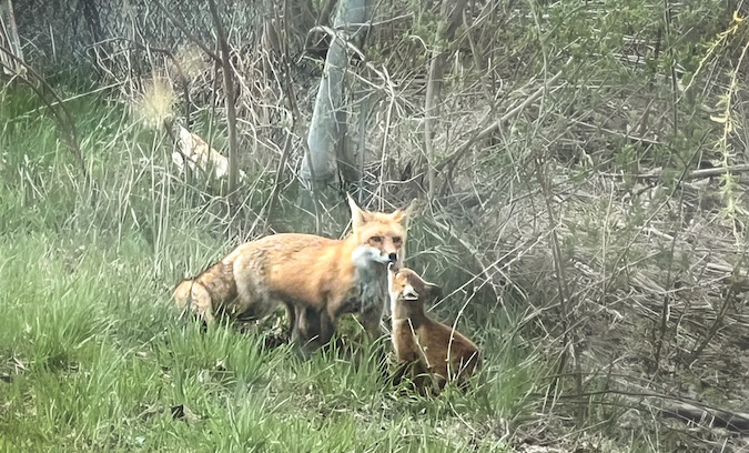
A baby fox gives its mother a kiss after crossing Platten Road in Lyndonville on Wednesday evening. Jennifer Orr took the photo. She said the momma fox had four babies with her.
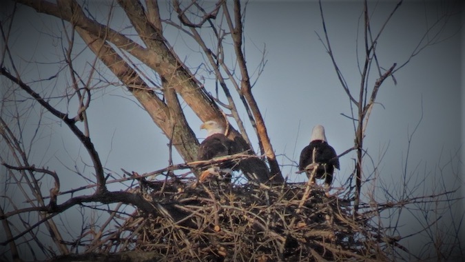
Garrett Knaak of Albion saw these bald eagles in a nest in Gaines recently. He doesn’t want to say the exact location so many people don’t go to the site and disturb the majestic birds.
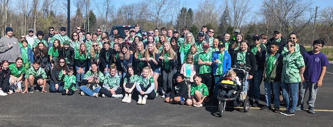
Provided photo: A group of about 75 Holley students and Rotary Club members last May 6 volunteered to pick up trash along 9 miles of the Erie Canal towpath and many of the village streets and parks.
Staff Reports Posted 14 February 2023 at 3:14 pm
Registration has opened for Canal Clean Sweep 2023. Parks & Trails New York, in partnership with the NYS Canal Corporation, is organizing the 18th annual Canal Clean Sweep April 21-23 in celebration of Earth Day.
Community service clubs, co-workers at a business or organization, Scouts or even families are encouraged to register for a spot or section of the canal. Or they can check back later to register as a volunteer for a public event. Use the Event Finder Map on Parks & Trails website.
Most events will occur on Earth Day weekend, April 22-24. However, volunteers can pick another day if it works better.
Click here to fill out a form to register a Canal Clean Sweep event, indicating the clean-up location, how many volunteers are expected, and what t-shirt sizes are needed.
After registering for a Canal Clean Sweep event, Parks & Trails will provide more information and materials.
Last year, not-for-profit organizations, civic groups, businesses, and social clubs took part in more than 130 events along the Canal System and the Canalway Trail as 2,700 volunteers helped clean up nearly 1,500 bags of garbage.
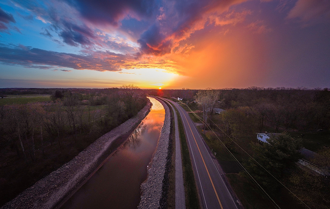
Photo by Tom Rivers: The Allens Bridge Road canal bridge in Albion is shown on Oct. 14, 2022.
By Tom Rivers, Editor Posted 9 February 2023 at 9:35 am
The Erie Canal water levels will again be about a foot lower for the 2023 navigation season, the Canal Corp. announced on Wednesday.
This is for the area between Lock E-30 in Macedon and Locks E-34/35 in Lockport.
This is the second year that levels have been reduced as the Canal Corporation continues to monitor more than 200 known seeps along the canal’s earthen embankments, the Canal Corp. said.
“Levels may vary slightly depending on the location,” the Canal Corp. stated. “The reduced water levels should not impact vessels transiting the canal within the navigation channel but may impact some docks and boat launches.”
In addition, water levels in the Glens Falls Feeder Canal will be approximately two feet lower than historic levels as seeps continue to be monitored there as well.
The Canal Corporation said it monitors and inspects these earthen dams on foot via daily and uses advanced technologies like drones and thermal imaging.
The 199th navigation season opens May 19 and closes Oct. 11.
By Tom Rivers, Editor Posted 26 January 2023 at 11:23 am
File photo by Tom Rivers: A boater heads east in Albion after passing under the Ingersoll Street lift bridge in this photo from Oct. 2, 2019.
The navigational season for the Erie Canal will run from May 19 to Oct. 11, the New York State Canal Corporation announced today.
This will be the 199th consecutive season of navigation, and for the seventh year in a row the tolls for recreational boaters will be waived. Those tolls were normally $25 to $100 for a season pass, depending on the size of the vessel.
The season will open at 7 a.m. on May 19 and close to navigation at 5 p.m. on Oct. 11.
The canal is now a year away from the 200th navigation season of the waterway that goes 363 miles, linking the Hudson River in Albany to Lake Erie in Buffalo.
It cuts through about 25 miles of Orleans County and includes seven lift bridges. That is more than any other county in the canal system, which has 16 lift bridges total.
Photo by Tom Rivers: Medina used a $10,500 “IMPACT!” grant from the Erie Canalway National Heritage Corridor towards an ADA-accessible kayak launch that was installed in September 2021.
Posted 9 January 2023 at 10:31 am
Press Release, Erie Canalway National Heritage Corridor
WATERFORD – The New York State Canal Corporation, through the Reimagine the Canals initiative, and the Erie Canalway National Heritage Corridor are offering competitive grant funding to support tourism and recreation along the New York State Canal System including canal waterways and Canalway Trail.
The 2023 program will support tourism infrastructure and amenity improvements, and events. Applications are open now through Feb. 24.
Funding is open to counties, municipalities, units of local government, not-for-profit organizations and federally recognized Native American tribes.
The grant program includes two funding categories: Event Support, with an award range of $500 to $3,000, and Tourism Infrastructure & Amenity Support, with an award range of $5,000 to $24,000. Applicants may apply for one or both categories.
“New York’s Canals and their surrounding communities have become destinations for local residents and tourists seeking unique recreational activities and provide opportunities to explore all of what our state has to offer, and it is essential to provide support to ensure continued growth and improvements,” said Canal Corporation Director Brian U. Stratton. “Through this grant program, we are excited to renew our commitment to preserve and expand all that our shared waterways and trails offer and look forward to seeing visitors enjoying the flourishing Canal System as we continue to build on its role as a cornerstone of the New York experience.”
In 2022, 38 nonprofit organizations and municipalities received NYS Canal System Tourism Infrastructure and Event Grants totaling $259,300. The grants supported 11 tourism infrastructure and amenity improvements and 27 events.
Interested applicants are invited to attend an informational Q&A session on Thursday, January 26, 2023 at 10am. For details, Q&A registration, and online application, click here.
“Investing in recreational amenities and heritage-based events is essential to the Corridor’s health, both in terms of improving residents’ quality of life and by facilitating the economic impacts of tourism. We are pleased to collaborate with the NYS Canal Corporation on this initiative and align our revitalization strategies,” said Bob Radliff, Executive Director of the Erie Canalway National Heritage Corridor.
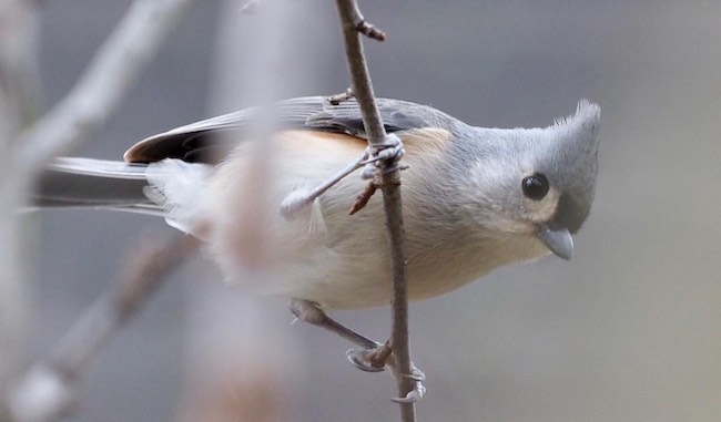
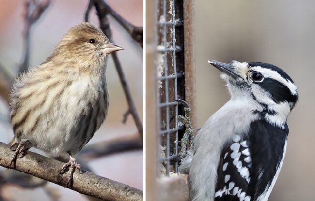
Photos courtesy of Celeste Morien: A Tufted Titmouse is pictured. Bird counters potted 30 of these birds in a recent Oak Orchard Swamp Christmas Bird Count.
Posted 19 December 2022 at 2:48 pm
Press Release, Celeste Morien, count compiler for Oak Orchard Swamp Christmas Bird Count
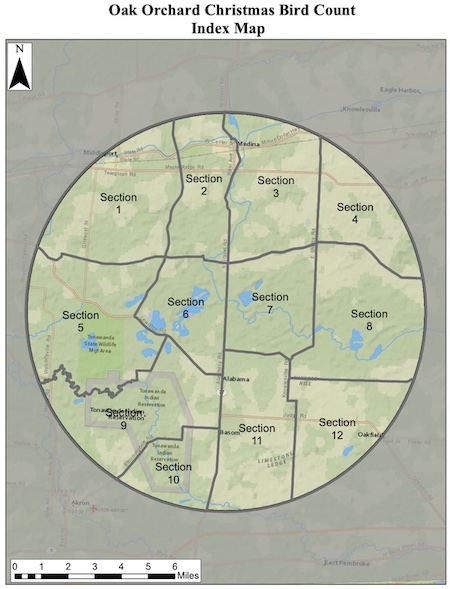
Here is the map showing different sections for the Oak Orchard Swamp Christmas Bird Count. One of the recent counts totaled 20,843 birds in 73 species.
SHELBY – The Oak Orchard Swamp Christmas Bird Count will be held on Wednesday, Dec. 28.
The count began in December 1968. The National Audubon Society has been sponsoring Christmas Bird Counts since their inception.
Count compiler and Medina resident Celeste Morien would like the public to be alert for counters with spotting scopes and binoculars who will be out and about Dec. 28 on local roads, searching for birds in fields and at bird feeders.
Filling bird feeders now and keeping them stocked ahead of the count helps fulfill the count objective of counting all wild birds seen and heard within the circle. The Oak Orchard Swamp count is centered at the Iroquois National Wildlife Refuge on the Orleans and Genesee County line at Route 63. Count volunteers follow specified routes through a designated 15-mile diameter circle, which includes more than the refuge and state wildlife areas, counting every bird they see or hear all day. It’s not just a species tally—all birds are counted all day, giving an indication of the total number of birds in the circle that day.
According to the Audubon website, “Prior to the turn of the 20th century, hunters engaged in a holiday tradition known as the Christmas “Side Hunt.” They would choose sides and go afield with their guns—whoever brought in the biggest pile of feathered (and furred) quarry won.
Conservation was in its beginning stages in that era, and many observers and scientists were becoming concerned about declining bird populations. Beginning on Christmas Day 1900, ornithologist Frank M. Chapman, an early officer in the then-nascent Audubon Society, proposed a new holiday tradition—a “Christmas Bird Census” that would count birds during the holidays rather than hunt them.
A Pine Sisken is at left and a Downy Woodpecker is at right.
So began the Christmas Bird Count. Thanks to the inspiration of Chapman and the enthusiasm of 27 dedicated birders, 25 Christmas Bird Counts were held that day. The locations ranged from Toronto, Ontario to Pacific Grove, California with most counts in or near the population centers of northeastern North America.
From Dec. 14 through Jan. 5 each year tens of thousands of volunteers throughout the Americas brave snow, wind, or rain, and take part in the effort. Audubon and other organizations use data collected in this long-running wildlife census to assess the health of bird populations, and to help guide conservation action.
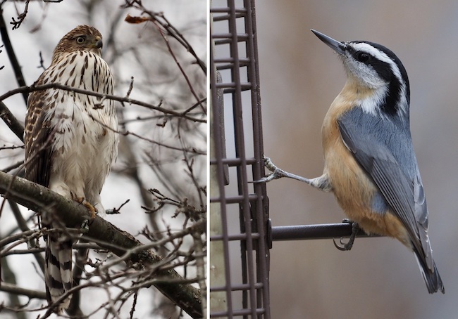
A Cooper’s Hawk is at left and a Red-breasted Nuthatch is at right.
The data collected by observers over the past century allow Audubon researchers, conservation biologists, wildlife agencies and other interested individuals to study the long-term health and status of bird populations across North America. When combined with other surveys such as the Breeding Bird Survey, it provides a picture of how the continent’s bird populations have changed in time and space over the past hundred years.
The long term perspective is vital for conservationists. It informs strategies to protect birds and their habitat, and helps identify environmental issues with implications for people as well.
If your home is within the circle and you are at home on count day, you can report the birds that visit your feeders. To do so, please contact celeste.morien@gmail.com.
Please consider donating to the Christmas Count since the Audubon Society no longer collects fees from each participant. Click here for more information.
For past results of any Christmas Bird Count, the National Audubon Society website (click here) is an excellent resource.
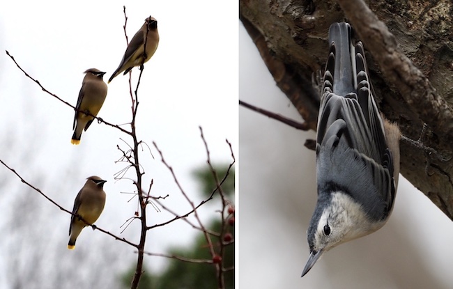
These Cedar Waxwings are shown at left with a White-breasted Nuthatch at right.
Provided image: The cover of the 2023 Erie Canalway Calendar features Tim Stephen’s photo of the Yankee Hill Lock at Schoharie Crossing State Historic Site near Amsterdam.
Posted 28 November 2022 at 12:11 pm
Press Release, Erie Canalway National Heritage Corridor
WATERFORD – The public is invited to pick up a free 2023 Erie Canalway National Heritage Corridor calendar starting December 1, 2022 at selected libraries and visitor centers throughout the National Heritage Corridor. The calendar features winning images from this year’s Erie Canalway photo contest.
“The Erie Canal transformed New York and the Nation and continues to contribute to the economy and sense of place of communities along it today,” said Bob Radliff, Erie Canalway Executive Director. “The calendar serves as a reminder to celebrate, preserve, and enjoy this incredible place all year long.”
Calendars will be available on a first-come, first-served basis, thanks to generous support from the NYS Canal Corporation and the National Park Service.
“There is a reason they call December ‘the most wonderful time of the year!’ The annual Erie Canalway Calendar is a perennial favorite, beloved and eagerly awaited by all,” said Canal Corporation Director Brian U. Stratton. “Released at the start of the holiday season with photos captured by our friends and neighbors in canalside communities, this calendar is a testament to the beauty of this historic and scenic waterway. We are proud to continue to support this publication as it brings the charm of New York’s canals into our homes and offices for all to enjoy.”
In Orleans County the calendars will be available at:
Hoag Library, 134 South Main St. in Albion
Community Free Library at 86 Public Square in Holley
Lee-Whedon Memorial Library at 620 West Ave. in Medina
Some other nearby locations include:
Seymour Library at 161 East Ave., Brockport
Brockport Welcome Center at 161 East Ave. in Brockport
Hamlin Public Library at 1680 Lake Rd. in Hamlin
Royalton Hartland Community Library at 9 Vernon St. in Middleport
174 crashes with animals in Orleans County in 2021
File photo by Tom Rivers: These deer are shown by West Barre Road in Barre on Oct. 12, 2018.
Press Release, AAA Western and Central New York
New York drivers need to buck up this fall and watch for animals on the roads. AAA analyzed New York crash data and found that October, November and December are by far the peak months for animal crashes, notably deer, in the Empire State.
There were 34,064 animal-related crashes statewide in 2021 – up slightly from 2020 – that’s equivalent to one animal-related crash every 16 minutes. Of the 34,064 crashes, there were 1,515 injury animal-related crashes and five fatal crashes.
AAA analyzed New York State data, and here are the top 10 counties for animal crashes in 2021:
Suffolk (1,367)
Monroe (1,358)
Orange (1,356)
Oneida (1,269)
St. Lawrence (1,260)
Jefferson (1,217)
Ontario (1,196)
Erie (1,008)
Onondaga (972)
Livingston (929)
Editor’s Note: AAA reported that for 2021, the number of crashes where “animal’s action” was listed as a contributing factor was 770 in Genesee County and 174 in Orleans County.
Motorists should be especially vigilant after dark as deer crashes often occur outside daylight hours. Crashes are most common near sunset (6 to 8 p.m. before the clock changes, 5-7 p.m. after the clock changes).
“Drivers should always be on the lookout for hazards on the road, but the danger of deer increases every fall,” said Elizabeth Carey, director of public relations at AAA Western and Central New York. “Car-deer collisions can be both deadly and costly. Drivers should pay close attention, avoid distractions and scan the road for deer when traveling on area roadways.”
AAA offers the following tips for avoiding, or mitigating, deer crashes:
1. Scan the road. Especially the shoulders of the road in front of you. Deer may dash out from the shoulder or wooded areas adjacent to the road. They often travel in herds.
2. Follow the speed limit. Keeping your speed down will give you more time to respond to unexpected wildlife movements.
3. Can’t avoid a collision? Apply the brakes firmly and remain in your lane. Swerving sharply to avoid an animal can often cause a more serious crash.
By Tom Rivers, Editor Posted 6 October 2022 at 8:05 am
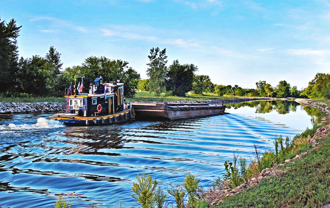
MEDINA – The top photo of a tugboat on the Erie Canal in Medina was taken by Peggy Barringer of Albion and won third place in the 2022 Erie Canalway Photo Contest. The photo is entitled, “Hard at Work” in Medina.
Barringer won a first place award in the contest in 2014. Her photo of the tugboat was the only award winner showing an Orleans County scene in the 2022 contest.
The 17th annual contest included four categories: Canal Communities, On the Water, Classic Canal, and Along the Trail. Barringer was third in the Classic Canal category.
“I’m just thrilled to be selected as a winner for the second time,” Barringer said by text. “I live along the canal so I live and breathe it. It’s part of my life!”
This photo – “Sunrise Stroll on the Erie Canal, Pittsford” – was taken by Alan Schwartz of Rochester and won first place in the Along the Trail category.
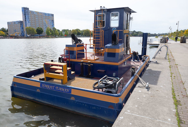
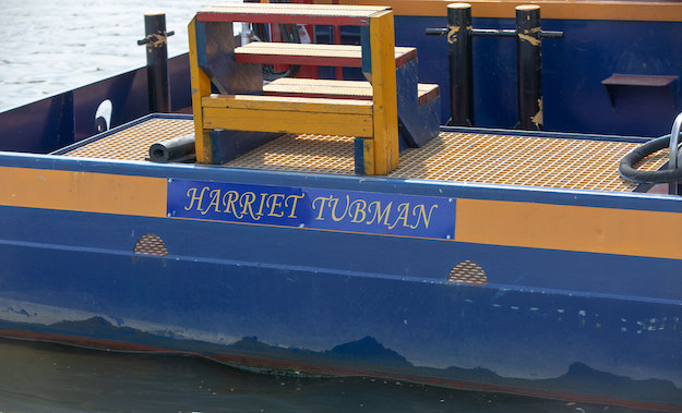
Photos courtesy of Canal Corp: Gov. Kathy Hochul and the Canal Corporation today announced a vessel on the canal will be named in honor of Harriet Tubman, a famed American. The announcement was made in Rochester, near Tubman’s home and final resting place in Auburn.
Posted 4 October 2022 at 8:59 pm
Press Release, Gov. Kathy Hochul’s Office
ROCHESTER – Governor Kathy Hochul today announced the New York State Canal Corporation has named one of their vessels the Harriet Tubman in honor of the famed American abolitionist and humanitarian’s inspirational life and legacy.
In the bicentennial year of Harriet Tubman’s birth, the Canal Corporation dedicated the previously unnamed push tugboat at a ceremony along the Genesee River spur of the Erie Canal in Rochester, not far from abolitionist’s home and final resting place in Auburn near the Finger Lakes.
“As we celebrate the 200th anniversary of Harriet Tubman’s birth, it is our honor to recognize her commitment as a self-sacrificing abolitionist, suffragist, Civil War hero, and nurse who made meaningful and lasting contributions to our state and America’s history,” Hochul said. “By naming a vessel in her honor, we are uplifting her story of great sacrifice and the unique role that our state’s canals played as part of the Underground Railroad.”
Tubman, a leading figure of the Underground Railroad movement who helped free dozens of enslaved people, made several trips along the canal corridor, where the Erie, Champlain, Oswego and Cayuga-Seneca Canals provided an accessible route to Canada for many Freedom Seekers.
“Harriet Tubman is one of the most crucial figures in our history, and her brave contributions add to the rich history of the canalway,” said New York State Canal Corporation Director Brian U. Stratton. “Today, we celebrate her life and legacy, as well as the role of the canal in the abolition movement, broadening the lens through which we understand the importance of this piece of our state’s history.”
At their September meeting, the New York Power Authority and Canal Corporation Board of Trustees voted to name this previously unnamed push tugboat in honor of Harriet Tubman who devoted her life to social activism and human rights.
The 2019 vessel is stationed along the Erie Canal at the Canal Corporation’s maintenance facility in Lyons, Wayne County. When working on the canal, the tugboat pushes other non-motorized vessels during transit. These vessels include derrick boats, dredges, and scows that are essential for performing routine canal operations such as dredging, buoy placement, debris removal, and transit of materials.
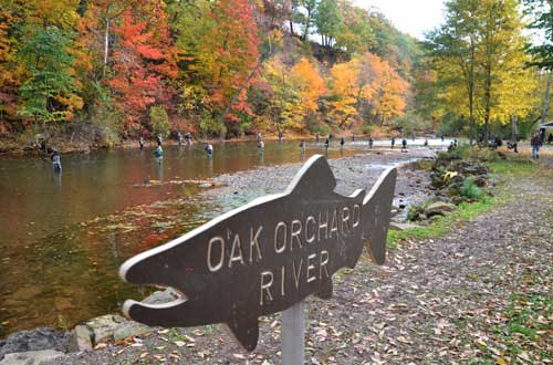
File photos by Tom Rivers: Fishermen try to catch salmon and trout along the Oak Orchard River in October 2015.
Governor Kathy Hochul today announced Saturday, September 24 as a Free Fishing Day in New York State.
This free freshwater fishing day is one of six held annually and coincides with National Hunting and Fishing Day, which is celebrated to promote outdoor activities that are significant contributors to New York’s economy and help support fish and wildlife conservation.
“From Babylon to Buffalo, Free Fishing Days are a great opportunity for New Yorkers to enjoy the outdoors at one of New York State’s many world-class fishing locations,” Governor Hochul said. “I encourage everyone to take advantage of this weekend’s Free Fishing Day, support New York’s local economy, and see the benefits of our extensive conservation efforts to protect and enhance our natural resources.”
On Free Fishing Days, New York residents and non-residents may fish New York’s fresh waters for free without a fishing license. Free Fishing Day participants are reminded that, although the requirement for a fishing license is waived, all other fishing regulations remain in effect. The sixth and last Free Fishing Day of 2022 is on Veterans Day, Nov. 11, 2022.
New York State Department of Environmental Conservation Commissioner Basil Seggos said, “DEC is thrilled to support Free Fishing Days throughout the year to help introduce people to the sport of fishing. Along with other improvements like our new Tackle Box feature on the HuntFishNY smartphone app, DEC continues to work to make fishing more accessible for local anglers of all skill levels to enjoy the excellent fishing in lakes, ponds, rivers, and streams in every region.”
Earlier this summer, DEC launched the new ‘Tackle Box’ feature to enhance fishing-related tourism and help new and experienced anglers enjoy the great fishing offered throughout New York.
The Tackle Box feature is available on DEC’s HuntFishNY smartphone app, (available for iOS and Android) which provides information on nearly all State fishing regulations, waterbodies, State-operated fishing access sites, stocking information, and other useful features like photos to help identify fish likely found in a certain river, lake, or stream. More information on the HuntFishNY Mobile app can be found on DEC’s website.
By Ginny Kropf, correspondent Posted 16 August 2022 at 2:01 pm
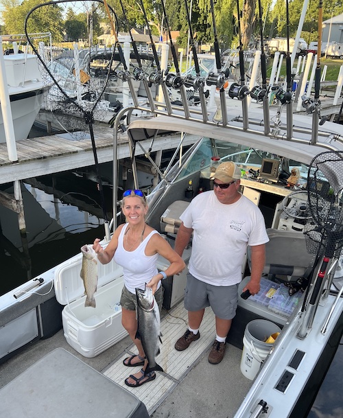
Provided photo: Robin Boyle of Waterport holds two of the fish she caught in last year’s Reelin’ for the Cure derby. She is shown with captain Mitch Polkinkowski of Hemlock. He keeps his fishing boat at Point Breeze.
OLCOTT – Reelin’ for a Cure is a group of ladies and captains who gather annually in August to fish for top prize money in an All-Ladies Fishing tournament to raise money for women fighting cancer.
Each year the RFAC committee selects a different benefactor to receive proceeds of the derby. This year’s event will benefit the Ovarian Cancer Project.
This year’s Reelin’ for a Cure takes place on Friday, with fishing from 6 a.m. to noon. The goal of the ladies’ teams is to catch the biggest trout or salmon and/or most up to six during the six-hour time frame. They are always looking for more captains and lady angler teams to participate each year, bringing more attention to the awesome sportfishing on Lake Ontario as well as coming together for one day to help in the fight of women’s cancers, said organizer of the derby, Stephanie Pierleoni of Newfane.
All boats leave from Olcott or Wilson harbors.
An after party for participants, their families and volunteers takes place after the weigh-in at 1 p.m. in Krull Park.
Pierleoni started the women’s fishing derby in 2016, after hearing about a similar one in Oswego.
“They donated the proceeds to support causes dealing with women’s cancer,” Pierleoni said. “I thought why can’t we do something like that on this end of the lake.”
She has always loved to fish and often fishes with her husband Vince, who has been a fishing boat captain since 2009. Her first Fishin’ for a Cure was huge success, and she has done it every year since. Ten boats participated the first year and 45 are registered this year.
Three captains are participating from Point Breeze – Tom Boddy, Mitch Polkinkowski and Rick Hajecki. Several others are entering from Bald Eagle Marina in Kendall.
Robin Boyle of Waterport participated in the derby last year in support of her sister Sherri Boyle of Morristown, Tenn., who was battling a metastatic breast cancer. Sadly, Sherri died July 16, prompting Robin to enter the derby this year to support the event in memory of her sister. Robin is a member of the team on Polkinkowski’s boat.
Some of the charities Pierleoni has donated to in the past include the Wig Room, Look Good Feel Better and the Breast Cancer Network of Western New York. Individuals may donate by logging on the Reelin’ for a Cure website and clicking on “Donate money.”
This photo – “Heaven Splits” – shows the Adams Basin and was by Joe Pompili of Spencerport and won first place in the Classic Canal category for the 2021 Erie Canalway Photo Contest.
Posted 4 August 2022 at 11:20 am
Press Release, Erie Canalway National Heritage Corridor
WATERFORD – The Erie Canalway National Heritage Corridor is calling for entries for its 17th annual Erie Canalway Photo Contest.
Images should convey people enjoying activities on the waterway and Canalway Trail or show the unique character of New York’s canals and canal communities. Entries must be postmarked by Aug. 26. Winning photos will be featured in the 2023 Erie Canalway calendar.
Images will be judged in four contest categories: On the Water, Along the Trail, Canal Communities, and Classic Canal. Judges will select first, second, and third place winning images in each category, as well as 12 honorable mentions.
Submitted images must be horizontal format and taken within the Erie Canalway National Heritage Corridor, which spans 524 miles across the full expanse of upstate New York. It encompasses the Erie, Cayuga-Seneca, Oswego, and Champlain canals and their historic alignments, as well as more than 230 canal communities.
Download official contest rules and an entry form by clicking here.
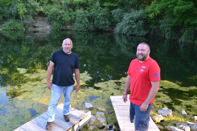
Photo by Tom Rivers: Scott DeSmit, left, is president of the Albion Sportmen’s Association, and Dan Conrad is a member who also ran a fishing derby in 2019 for DC Outdoors. The two are working together planning a fishing derby on Aug. 13 at the Sportsmen’s Association on Keitel Road in Albion.
By Tom Rivers, Editor Posted 18 July 2022 at 4:48 pm
ALBION – A youth fishing derby will be back in Albion on Aug. 13 after being cancelled the previous two years.
This will be the 26th Daniel Spierdowis Memorial Fishing Derby. It will be at the Albion Sportmen’s Association on Keitel Road. There are two former quarries at the site where there are good chances of catching large-mouth bass, crappy, bluegills and bullheads.
The derby is named in honor of Danny Spierdowis, who loved the outdoors, especially fishing in the former Peck quarries at the Sportsmen’s Association.
Spierdowis was killed in a car accident at age 19 on Jan. 20, 1990. His mother Linda remains active at the Sportsmen’s Association, tending to the flowers at the clubhouse.
The derby is open to Orleans County residents 16 and younger. Participants are encouraged to bring their own poles but there will also be some available at the derby.
The derby goes from 9 a.m. to noon, with registration starting at 8 a.m. Prizes go for the biggest fish caught, and also the heaviest cumulated weight of all the fish caught.
Winners will get a fishing pole and tackle box with some tackle. Everyone who participates is welcome to stay for lunch.
There is no charge to the participants. Preregistration is urged by calling Scott DeSmit at 585-815-5150. People can leave the participants’ name, their age and if an adult will be available to help during the derby. Or they can call Dan Conrad with the same information at 585-590-1148. People can also stop by Conrad’s store, Toyz n Kandy, on East Bank Street in Albion to preregister. Preregistration is urged by Aug. 10.
Conrad ran a fishing derby in 2019 with DC Outdoors that had 76 participants. He said he is pleased to assist DeSmit and the Sportsmen’s Association with this year’s derby. He is hoping for 100 participants.
“We need to get more kids in the outdoors,” he said.
He urged first responders – police officers, deputies, firefighters, medics and others – as well as any military and veterans to volunteer that day to help some of the kids who have never fished before and could use pointers getting worms on a hook and taking the hook out of a fish’s mouth.
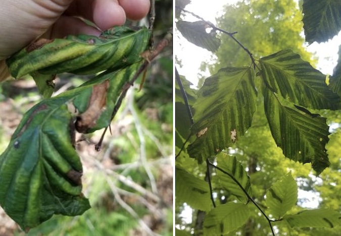
Photos courtesy of DEC: The photo at left shows advanced symptoms of Beech Leaf Disease and the photo at right shows heavy and light striping on the leaves.
Posted 15 July 2022 at 1:12 pm
Press Release, NYS Department of Environmental Conservation
The New York State Department of Environmental Conservation today announced that Beech Leaf Disease (BLD), which affects all species of beech trees, was identified in 35 counties in New York State to date.
DEC began tracking BLD in 2018 after it was confirmed in Chautauqua County. Fourteen of the counties with BLD were confirmed in 2022, and more are likely to be identified. Editor’s note: The DEC reports BLD was first observed in Orleans County in 2020.
“Many American beech trees are already heavily impacted by beech bark disease, but Beech Leaf Disease appears to be an even bigger threat,” said DEC Commissioner Basil Seggos. “The decline of beech in New York could have far-reaching consequences, including significant changes to the composition of our northern hardwood forests and the loss of a valuable food source for wildlife. Beech Leaf Disease affects all beech, so the impacts would also be felt in our urban forests where ornamental beech trees, including the popular copper beech cultivar, are widely used for landscaping and street trees.”
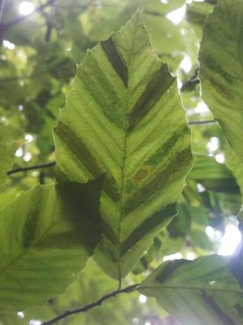
This leaf shows striping caused by Beech Leaf Disease.
Much is still unknown about BLD, including how it spreads, but it can kill mature beech trees in six to 10 years and saplings in as little as two years. There is no known treatment for infected trees.
BLD symptoms are associated with the nematode Litylenchus crenatae mccannii. It is unknown whether the nematode causes all of the damage, or if it is in association with another pathogen such as a virus, bacteria, or fungus.
DEC is working with the Cornell Plant Disease Diagnostic Clinic, the U.S. Department of Agriculture Forest Service, neighboring states, and New York’s Partnerships for Regional Invasive Species Management to survey for new infections, track disease progression using long-term monitoring plots, and investigate the nematode’s role in the disease. More information is needed to develop an effective treatment.
DEC’s Forest Health Diagnostic Lab is experiencing a recent surge in requests for BLD diagnosis and treatment options as landowners begin to notice a rapid decline in the health of their beech trees. Most of the reports are from Suffolk and Westchester counties where BLD is widespread.
DEC is asking the public to submit reports through NYimapInvasives if they encounter a beech tree showing signs of BLD, especially for counties where BLD has not yet been confirmed.
The main symptom to look for on beech foliage is darkened striping between the veins, which is best seen when looking up through the canopy. Leaves with severe symptoms can be heavily banded and crinkled, with a thickened leathery texture.
At this time there are no specific recommendations for managing trees that are infected with BLD, however, DEC encourages the public to report potential BLD infections using iMapInvasives to help track the disease while research is ongoing.