


Which Roosevelt is Roosevelt Highway named for?
Construction of Route 18 started in 1920s in Orleans County
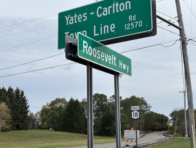
Photos by Tom Rivers: Roosevelt Highway at the Yates-Carlton town line is shown on Saturday.
By Catherine Cooper, Orleans County Historian
“Illuminating Orleans” – Volume 5, No. 37
A recent drive along Route 18 prompted the question: Which Roosevelt is the Roosevelt Highway named for?
As is often the case with a seemingly simple question, it led to many layers of discovery. It transpires that this is a road of many names. It was originally known as St. John’s Road, most likely from St. John’s Lutheran Church in the Countyline hamlet. It is now generally referred to as Route 18. In addition to being part of the Roosevelt Highway, it is also designated as the Great Lakes Seaway Trail.
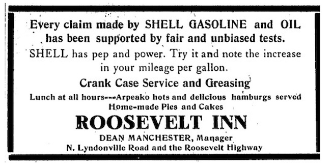
This gas station operated from 1930 to 1943. Arpeako was a hot dog brand.
President Franklin D. Roosevelt would seem to be the obvious choice for the road name because of his association with efforts to stimulate the economy during the Depression. Also, he was a friend of Orleans County Judge Bernard Ryan. Franklin and Eleanor Roosevelt visited the Ryans on two occasions.
But the honor goes to Theodore Roosevelt.
Shortly after his death in January 1919, a civic group in Minnesota proposed the construction of the Theodore Roosevelt International Highway, an automobile trail across the north of the country, from Portland, Maine to Portland, Oregon. The name was later changed to Roosevelt Memorial Highway, though Roosevelt Highway is the most common usage.
The first reference to the road in the Orleans County newspapers was in a July 3, 1919, edition of the Lyndonville Enterprise. The North County Notes correspondent wrote: “Preparing to make the new Roosevelt Highway attractive, D.E. Kenyon and John Beckwith are giving their buildings a new coat of paint.” We detect a note of humor there.
The Olcott Beach to Somerset section of the Roosevelt Highway was completed in 1923. It traversed the famous fruit belt of Niagara County was described as “one of the finest drives in Western New York”.
In November of 1923, a 10-year plan for road development proposed a continuation of the Roosevelt Highway through Orleans and Monroe counties, on through Oswego to St. Lawrence County.
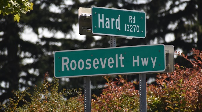
Roosevelt Highway at the Hard Road intersection is an area in the Kuckville hamlet in the town of Carlton.
The Orleans County Board of Supervisors adopted a resolution in March 1926 requesting the state highway department prepare plans for the improvement of county roads, including the Roosevelt Highway, a distance of 25 miles, connecting Monroe County through Hilton to Rochester and west through Niagara County to the Niagara Frontier.
W.J. Gallagher of Medina was awarded the contract to construct a concrete road from Countyline Corners to Kuckville, a 10-mile stretch which would include three small bridges as well as a bridge at Kuckville, “the longest highway bridge built in the county.” The cost to the county was $215,600, total cost was $678,000. “When finished it is expected to make a scenic and historic route between the Genesee and Niagara rivers, running at times along the southern shore of LO.”
The route was based on an east-west trail formed by Native Americans and early settlers, because of its proximity to the lake. The Medina Daily Journal of 21 August 1929 noted that several log houses were still in existence along the route but by then were being were used as farm buildings.
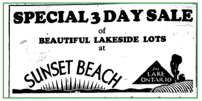
Soon “desirable summer home sites” such as these lots at Sunset Beach “reached by good auto roads” were being advertised. Nineteen people purchased lots the first week they were placed on the market.
Incidentally, there’s still a short section of road named St. John’s Road in the Town of Yates. It runs from Power Line Road to East Lake Shore Road.
Medina Tribune ad., May 1930