


Trees, heavy brush being cleared from old canal loop in Holley
Holley has only original section remaining west of Rochester
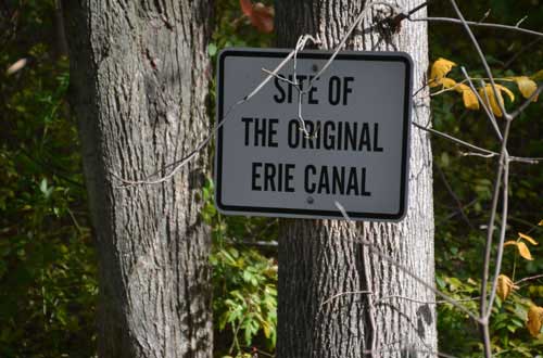
File photos from October 2015 by Tom Rivers: A small sign on a tree in a ditch in Holley notes that this was part of the original Erie Canal loop that meandered to the Public Square area of Holley.
HOLLEY – For several years it’s been talked about as a hidden gem in Holley, a potential tourism draw that can also enhance Holley’s trail system.
Today, the Orleans County Highway Department brought an excavator to Holley and started to clear out the only remaining original canal loop west of Rochester. The remaining original section of the canal is about 1,000 feet long. Trees have sprouted in the canal bed, as well as other heavy vegetation, including invasive plants.
Mayor Brian Sorochty credited former County Legislator George Bower of Holley for pressing the issue. Bower the past two years has urged Sorochty and the village to clear out the trees, brush and weeds from the canal bed, and make it a bigger asset for the community.
The Holley mayor thanked the county crew for working on the project as part of a shared service with the village.
Sorochty said the first goal is to get the canal bed cleaned out and the banks reformed. Longer-term he could see a pedestrian bridge with a display about the original canal loop. Perhaps the section could be rewatered with the canal supplying the water, Sorochty said.

This map displayed in the office of Dr. Dan Schiavone, shows the Holley Loop. It linked back to the canal just west of Bennetts Corners Road.
The original loop was created when the state veered the canal from a relatively straight line in 1823 due to the high banks and engineering challenge in dealing with Sandy Creek.
There was an unusually deep ravine formed by the east branch of Sandy Creek, which presented a difficult engineering problem for builders of the original Erie Canal in the early 1820s, according to display on the north side of the canal by the Holley lift bridge. The State Canal Corp. put up that display about “The Holley Loop.”
Rather than try to build the canal on the ravine, engineers opted to take a sharp turn near the current lift bridge and cross over a relatively narrow section of the creek.
“The sharp curve required boaters to slow down, which made a promising location for canal-oriented businesses,” according to the state display. “The Village of Holley grew at this bend in the canal.”
The canal was widened throughout the 363-mile-long system from 1905 to 1918 and much of the original canal was replaced by the wider and deeper canal.
But in Holley, some of the original remained because it wasn’t touched as part of the Barge Canal widening in the early 1900s.
The state in 1854-61, decided the original loop needed to be straightened out in Holley to create a shorter, more navigable waterway. A new section of the canal was built over a very high and long embankment.
“Because state law did not allow canal sections to be abandoned in villages or cities, the old loop was still used for several decades to serve local businesses,” according to the state display about the Holley Loop. “Canal traffic no longer stopped in the village, however, and eventually the loop was drained and eliminated. Traces of the original canal can still be seen east of the Public Square.”
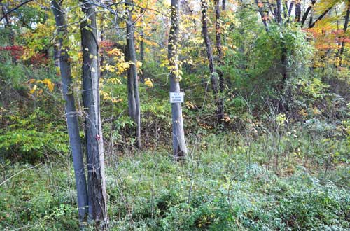
The original canal bed has trees and lots of thick vegetation that will be cleared out.


