Shelby was first town in Orleans to assign numbers to rural houses
By Catherine Cooper, Orleans County Historian
“Illuminating Orleans” – Vol. 3, No. 29
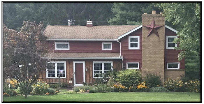
SHELBY – Prior to 1960, the address for this West Shelby home, then owned by Carl Hansen, was RD 2, Box 153. Following the assignment of rural numbers, the address became 5272 West Shelby Rd. It has been the home of Gary and Norma Jones since 1960.
In 1960, Shelby was the first Orleans County town to assign numbers to the homes and lots along its rural roads. This was part of a regional effort to identify rural properties more easily, spearheaded, not by the postal service, but by the Niagara Mohawk Power Corporation.
Rural delivery routes had been established when rural mail delivery began in 1896. Homes were identified by their delivery route number and the postal box number, e.g. RD 2, Box 153. While this identified the home on that route, it was not unique or specific. There could be several instances of similar “addresses” in a county. One could not easily identify where RD2 was, as it was a delivery route, not a road. Rural dwellings were difficult to locate in emergencies.
On July 2, 1959, the Orleans County Board of Supervisors unanimously adopted a resolution to approve the countywide rural road numbering plan outlined in the Master Plan for Development prepared by the Niagara Mohawk Power Corporation. The motion had been proposed by Supervisor Manley S. Morrison of the Town of Yates, seconded by Supervisor Lester Canham of the Town of Gaines. They had been part of a committee which had studied the Niagara Mohawk proposal and had concluded that rural numbering was of value and would prove beneficial to utility companies, fire companies, police officers as well as to the public.
However, the Board of Supervisors noted that it was “not authorized by law to expend money for said purpose” and that any of the towns who decided to adopt the plan would have to do so at their own expense. Fortunately, Niagara Mohawk, which had developed the uniform numbering system, offered to supply maps and other material to the townships at no cost.
The Town of Shelby voted to proceed with the project at a March 7, 1960, meeting.
Raymond Pahura, Town of Shelby Supervisor, Norman Anstey, Town of Shelby assessor, and Niagara Mohawk consultant Morris Lloyd of Buffalo began the process in May 1960. Beginning at the Niagara County line and working eastwards, they used a “measuring wheel” to mark off the lengths of vacant and occupied lots and assign individual numbers to each lot.
The Niagara Mohawk plan delineated that odd numbers would be assigned on the left side of the road and even on the right, generally numbering from east to west and from south to north. The project took a few weeks to complete.
Emergency agencies and medical personnel were then supplied with a master chart of the Shelby numbers. Property owners and tenants were notified of their assigned numbers and encouraged to use them.
The rural numbering system proposed by Niagara Mohawk to specifically identify properties thus became the basis of our address system.


