


Historic Childs: Proctor Brook, usually a gentle stream, drew pioneers to hamlet
By Doug Farley, Cobblestone Museum Director; and Bill Lattin, former Director
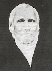
John Proctor
GAINES – The presence of water was an important consideration for pioneers to this region when they were looking to purchase property. Plentiful fresh water was important for livestock, crop irrigation and much more.
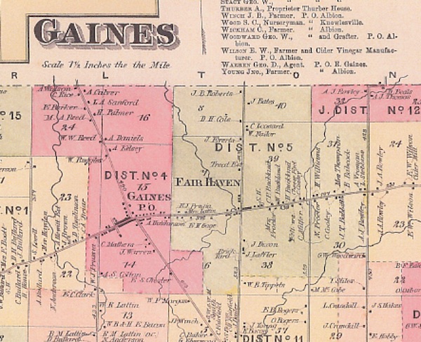
John Proctor would have pondered the same considerations when he acquired his land from the Holland Land Company in the early 1800s. The meandering brook that now bears his name probably played heavily in his decision to locate his prototype community of Fair Haven (now Childs) at the intersection of the Ridge Road and Oak Orchard Road.
When and how Proctor Brook got its name is not recorded, but most likely honors the community’s founding father.
Time marches on, and over time, little attention was paid to Proctor Brook, so little, that folks had pretty much forgotten its name. Town of Carlton Historian Lysbeth “Betsy” Hoffman recalls “re-discovering” the name in the 1980s when she was reviewing 1820s Town Board Minutes.
In those documents, she saw frequent references to the name Proctor Brook, which grabbed her attention and got her thinking about the probable location of this mystery waterway. Betsy contacted Mike Slack from the abstract office at the County Clerk’s Office, and he verified that Proctor Brook was indeed the historic name assigned to the little tributary that crosses the Ridge Road at Childs while winding through the towns of Gaines and Carlton.
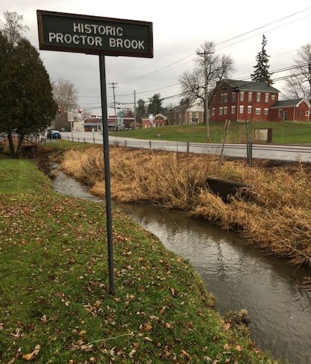
In an effort to make sure the community didn’t forget the name of Proctor Brook again, and to commemorate John Proctor for posterity, a fitting sign was built by Cobblestone Museum volunteer George Callard and erected near the brook on the grounds of the Museum’s Route 98 campus.
Assisting in this effort was Town of Gaines Historian Dee Robinson, Town of Carlton Historian Betsy Hoffman, and Orleans County Historian Bill Lattin. A dedication ceremony for the sign took place on September 11, 1988.
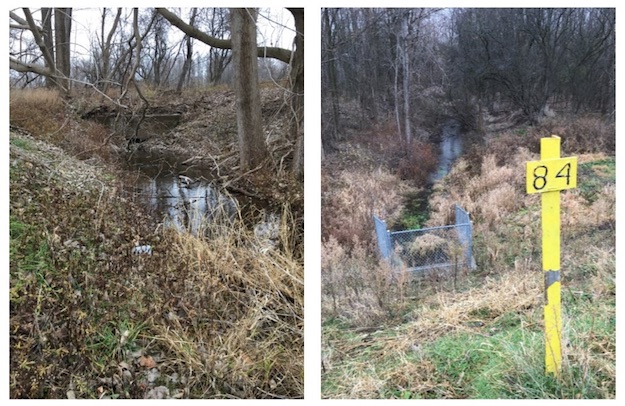
Proctor Brook has its geographic beginning in a marshy area around the present day Sheret American Legion Post on Gaines Basin Road. From there it travels north and approaches the Erie Canal as shown above left. Then it goes under the canal through a sleuth located west of the canal guard gate and exits on the north side of the canal bank as seen above right. It then meanders mainly northward, but sometimes east and west, too.
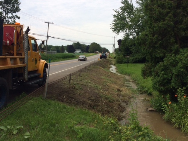
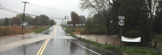
Proctor Brook enters the Hamlet of Childs alongside Route 98 near the Cobblestone Museum’s artisan buildings as seen here with the NYS DOT crew cleaning up the bank. The brook then travels through the Museum campus and crosses Route 104 just west of the Village Inn. From there it continues through the Town of Gaines until reaching Carlton where it joins forces with Marsh Creek and heads on to Lake Ontario.
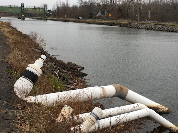
At some point in the mid- 20th century, Proctor Brook received a boost with a new supply of water diverted through an Erie Canal syphon. As seen here, the syphon is located west of the canal guard gate.
Farmers can petition NYS to receive a permit to use that water supply for their crops or other needs. Excess water from the syphon drains into Proctor Brook. Jim Kirby utilized the syphon for his farming for many years. Former Orleans County Historian Bill Lattin recalls one year in the late 1900s when Kirby said the syphon stopped working. He investigated the situation and discovered a large turtle had been sucked into the vortex and got stuck, effectively closing off the water supply. Kirby said, “Getting that thing out of there was a nasty job.”
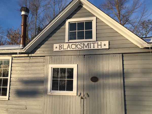
Proctor Brook has had some man-made adjustments made to its course, too. In 1921 the original Blacksmith Shop at the corner of Routes 104 and 98 caught fire and burned to the ground. Local farmers knew the absence of a local blacksmith shop would negatively impact their livelihood. Bill Lattin described their desperation, “The farmers, while the embers were still hot from the fire, pitched in to help blacksmith Joseph Vagg rebuild his shop.”
But, this time they decided to site the blacksmith shop a little further south to help protect Joe’s home from catching fire, too. To do so, they needed to relocate Proctor Brook which would have gone right through the new shop. So, the farmers and Vagg set about moving Proctor Brook about 20-25 feet south to make way for the new structure. They did that by dropping boulders into the creek bed that effectively moved the brook, making a sharp turn to the west, and then follow its current course to the south of the shop.
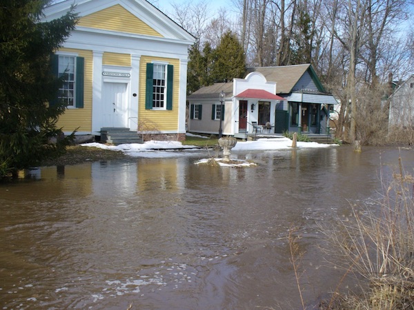
Proctor Brook, usually a very gentle little stream, is known to have an annual freshet or spring flood, usually in May or June. Some have been pretty severe. Melva Vagg Warner, Joe Vagg’s daughter, recalled that during one particularly severe flood, she kept track of Proctor Brook’s high water point by placing a mark on the side of her barn that sits next to the brook.
That marking came in handy in 1977 when the Cobblestone Museum was relocating its Print Shop to the grounds on the banks of Proctor Brook, and pondered how high to elevate the shop to avoid potential flooding. Bill Lattin said that Town of Gaines Highway Superintendent Cliff Kelley used a transit and Melva Warner’s water mark to determine a presumably safe position.
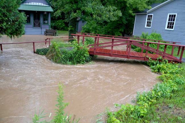
That theory was tested in the 1980s when the spring thaw resulted in flooding that came to within one inch from overflowing the floor of the Print Shop.
At that point, the water rose to over 1 foot above Route 98. It was during that flood that the Cobblestone Museum’s historic wooden cattle trough, usually located in front of Farmers Hall, floated downstream and ended up at the cobblestone house on Route 104.
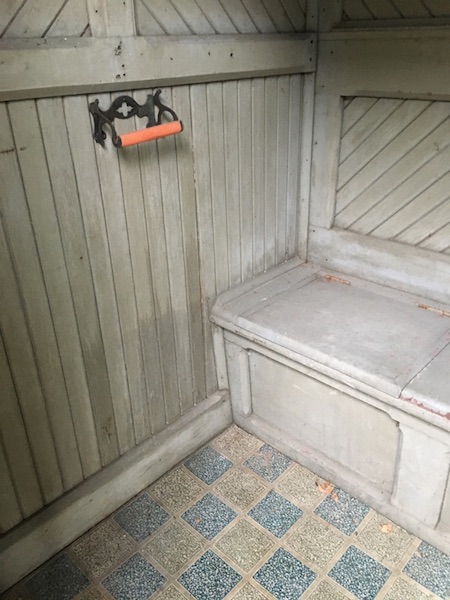
The high water mark for that flood is still visible inside the Eastlake outhouse located next to the Print Shop. The water line is just above the row of seats.


