


Flood watch in effect through late Wednesday night
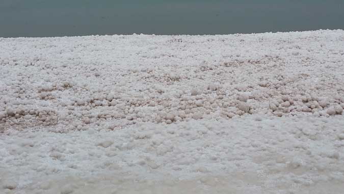
Michael Smith sent in those photos of the shoreline at the Shadigee in Yates. He took the pictures on Jan. 30. The Kodak retiree said he drove the Lake Ontario State Parkway for 30 years and “never once saw this type of formation along the shoreline over 30 different winters.”
A flood watch is in effect through late Wednesday night for several Western New York counties, including Orleans, Genesee, Niagara, Wyoming, Erie, Cattaraugus and Chautauqua.
“The combination of snow melt and rain may result in water rises and ice jams on area creeks and rivers,” the National Weather Service in Buffalo said. “Due to the recent lake effect snow event in WNY this past week, liquid amounts in the snow pack average 2 to 4 inches. Ice jams will be possible. Rainfall during the watch will average around a quarter inch.”
With a high forecast for 60 today there will be extensive snow melt in Orleans County. A period of rain will also occur tonight, although rainfall amounts will be light and less than a quarter inch, the Weather Service said.
The high today of 60 will followed by highs of 38 on Tuesday, 31 on Wednesday and 41 on Thursday, according to the Weather Service.

This photo shows a closer look at the ice balls and formations by the shoreline in Yates.