


College student from Albion walked entire canal during pandemic
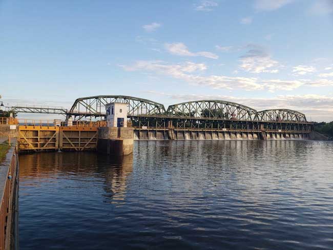
Photos courtesy of Jules Hoepting: From left to right shows Lock 8 and the moveable dam in Rotterdam, in Schenectady County.
Jules Hoepting used her days off to cover about 600 miles on foot along famed waterway from Buffalo to Albany
By Jules Hoepting

Jules Hoepting is pictured by the Barge Erie Canal in Gaines.
It was an interesting summer that led me to do an unexpected thing; I walked the entire Erie Canal Trail from Buffalo to Albany.
I’m Jules Hoepting – a 20-year-old public relations major attending SUNY Fredonia. Like millions of other students, when COVID sent me home in early spring, I wasn’t sure what to do with myself. I needed something to do, someplace to go.
The Erie Canal is half a mile from my house in Albion; I have spent a lot of time on its trail over the years. I biked alongside my mom as a little kid, I went for walks with the family dog, I even had my high school senior photos taken on the trail. The canal is a place I gravitate towards; I find it calming. It brings about a sense of home.
On the trail, I kept walking further and further to the East and West of Albion, walking from town to town, parking my car wherever I left off on the trail and trekking on further. I wanted to see new parts of the trail. I wanted to see where the water went, how the canal changed.
I had seen the trail from Medina to Holley from walks in previous years. This summer, I initially planned on walking from Lockport to Spencerport. Once I finished that, the plan grew to walking from Buffalo to Rochester. After I got to Rochester, I kept heading east – no destination in mind. I toggled with the idea of doing the whole way for a few weeks before committing to it.
So, how long is the trail exactly? That is a complicated question. The bike route mapped-out by Cycle the Erie Canal is 360 miles long. Because the Erie Canal trail is incomplete, approximately 70 miles of that route is made up of roads. Thus, the trail itself is around 290 miles long.

Erie Canal Trail, outside of Rome. Old Erie Canal to the right.
For the most part, I skipped the road portions of the route and stuck to the trail. I made additional side trips to visit every single lock on the Erie Barge Canal, bringing my mileage to 297 miles. Because I walked by myself, every section I walked, I walked twice, bringing my total mileage up to 594 miles.
On my two days off from work per week, I drove to wherever I left off last time. When it became too far to drive to and from new locations on a single day, I started doing three-day, two-night trips, spending the night in motels. A typical day would consist of walking 3 to 8 miles, walking back to my car, refilling my water bottles, then walking some more. I averaged around 20 miles a day, completing 10 miles of the trail at a time. Walking the entire trail took about a month’s worth of days; I started sometime in April and finished on August 31st.
What encompassed those hundreds of miles?
If you’re like me, your entire understanding of the Erie Canal is based off of what it is in Albion and nearby towns. You probably assumed that the canal looks like what it does in Orleans County across the entire state. It very much does not.
Old Erie Canal, Durhamville.
Orleans County is a part of the flattest section of the canal, a 60-mile section between Lockport and Rochester where there are zero of 35 locks. The county is home to seven of the 16 lift bridges and three of the 19 sluice gates on the canal. Next to the trail, the shoreline is almost entirely clear-cut, allowing for full views of the water; this contrasts the majority of the trail, where vegetation grows on either side of the trail. Orleans County has one of the most authentic sections of the canal, as most of the original Erie Canal is abandoned or filled in.
Yes, abandoned. Quick history lesson.
The Original Erie Canal, aka “Clinton’s Ditch,” was completed in 1825. It was 4 feet deep and 40 feet wide, stretching 363 miles from Buffalo (now Canalside) to Albany (now a historic marker). Construction began in Rome and the majority of the canal was dug by men, many of them immigrants, much of the engineering made up as they went along.
The “ditch” became such a popular means of transportation that it became necessary to enlarge and slightly reroute the canal. In 1862, the Enlarged Erie Canal, aka “Old Erie Canal” was completed. It was 7 feet deep, 70 feet wide and 350 miles long. As more time went on, the demand for having an even bigger canal grew significantly. Completed in 1918, the canal was enlarged and rerouted a second time, now 12-14 feet deep,100-200 feet wide and approximately 340 miles long, stretching from Tonawanda to Waterford near Albany.
The canal’s route altered drastically during the second enlargement, most of it being put into natural rivers. When the Erie Canal was originally constructed, it was built parallel to the Hudson River, Mohawk River, and Niagara River because the technology to control the rivers for navigation did not yet exist. Almost a century later, that technology existed; thus, most of today’s “Erie Canal” is in said rivers via a series of movable dams and locks.
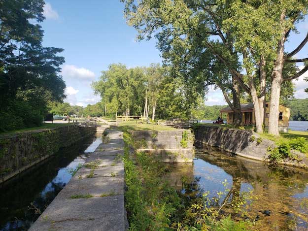
Remains of a double lock on the Old Erie Canal, Schoharie’s Crossing State Historic Site, Fort Henry.
During its second enlargement, the Erie Canal became a part of the New York State Barge Canal System, which combines the Erie, Oswego, Cayuga-Seneca and Champlain canal with a series of rivers and lakes to allow navigation across New York State. The Barge Canal is the canal you see running through Orleans today.
The Erie Canal trail follows the historic 1862 canal, which means that a lot of it is next to a swampy, weed-filled ditch where the occasional beaver resides. A good portion of the canal was drastically rerouted in the early 1900’s to utilize the Seneca River, Oneida River, and Oneida Lake, leaving several towns with a ditch running through the center of them and a financial scar.
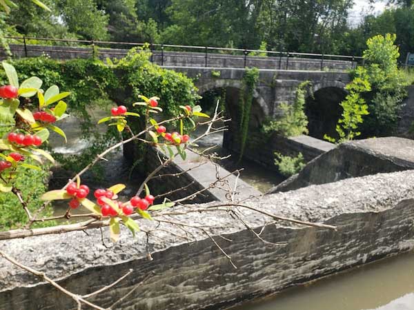
Some of the old canal is completely full, as it is used as a water feeder to the Barge Canal. Some sections have been restored or preserved quite nicely, such as Schoharie’s Crossing State Historic Site in Fort Henry, where you can see the 1825 canal meet the 1862 canal at an old lock. A distinction between the Old / Enlarged Erie Canal and the Erie Barge Canal is that the old canal has double locks instead of single locks, which allowed barges to travel through them in both directions. The old canal also had aqueducts, which acted as bridges for the water to pass over other water, while the modern canal lets creeks pass underneath its embankment. You can find a fully restored canal aqueduct over the Nine Mile Creek in Camillus.
Remains of an aqueduct in Old Erie Canal Park, DeWitt.
A good chunk of the Erie Canal is now I-90. In Mohawk Valley, there is limited space for where things can be built due to the mountainous geography. For centuries, the Mohawk River was the only means of getting through the valley. Then the Erie Canal was built next to the river. Then railroad tracks were built on both sides of the river. Then the Erie Canal was put into the river.
After that they filled in the former canal and built the I-90. During this section, the Erie Canal trail is on a former railroad track with the Thruway to the left of it, the river to the left of that and an active railroad to the left of that. The trail is like that for 20 miles or so before it is again closer to the water than the interstate.
If asked what my favorite sections of the canal are, I’d say Adam’s Basin near Spencerport, Lock 17 in Little Falls (one of the tallest locks in the world), and the Flight of Locks in Waterford (the first five locks are within the first two miles of the waterway). And, of course, the Brown Street Bridge in Albion will always be special – it’s the place where my journey began.
By stopping to read all the historic signs along the trail, I learned a lot about the canal. My teachers weren’t kidding when they said the Erie Canal had a huge impact on the state; it’s no coincidence the canal passes through all of Upstate New York’s biggest cities – Buffalo, Rochester, Syracuse, Schenectady, Albany – and connected them to the biggest city in the United States, New York City. I’ve noticed several roads and streets named “canal,” “Erie,” “towpath,” or “___’s Basin” in several towns.
Because I walked the trail, I had more time to soak it all in. To watch the landscape change as I crossed the state, from flat plains to the outskirts of mountain ranges. To take almost 3,000 pictures, attempting to capture my surroundings. To enjoy the oddities, like crocheted tree sweaters, ditched grocery carts and fascinating graffiti. To crawl onto abandoned bridges and marvel at how quickly the Earth has reclaimed them. To marvel at what the canal was and see it as it is – a symbol of the past.
It was an interesting summer that led me to do an unexpected thing, and it was worth every mile.
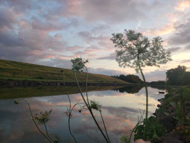
Erie Barge Canal, between Densmore and Transit Road, Albion.


